←nice–jausiers | | lantosque–castérino→
Thurs 25 May: Jausiers – Isola (870m) (67km, 1670m ascent)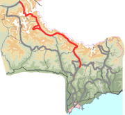
The road to the Bonette climbs steadily through pastureland with good views to Mt. Pélat (3051m) to the west. Higher up the terrain again becomes bleaker – I suppose the vegetation has not yet come to life. There is plenty of snow. The road is clear to the pass, but the loop round the Cime is still partially snow-covered. We manhandle our bikes along it, pose bythe stele, and walk to orientation table at the summit. In the distance Monte Viso (3841m) is a striking sight.
There is an English family enjoying the views. After we’ve chatted to the parents for a while the children ask “Mummy, are they English?”
A young French couple notice our laden bikes. «C’est le vrai courage» says the man to the woman.
Bonette climb | ||||
A steep descent, greener on this side of the pass, to Bousiéyas where there are some attractive houses but the refuge is shut. Ride on to St. Étienne de Tinée and lunch.
A cycle route is being build alongside the road from St. Étienne to Isola. The descent is hampered by a stiff breeze blowing up the valley.
Notes: There were no facilities between Jausiers and St. Étienne. The Hotel de France at Isola is basic. The village itself, full of trompe l’œil, is attractive.
From near the pass we were able to look down on the track leading from the Moutière to the Restefond. Much of it was under a thin coating of snow, but it was not steep and the route would probably have been pushable where it wasn’t ridable.
Now that we had the Bonette behind us we were free to worry about our next uncertainty: the Col Mercière. Since this is not a motor route, information about its state is hard to come by. But we knew that the nearby Col de la Lombarde, an international pass a mere 8m higher than the Mercière, was still shut.
Fri 26: Rest day (56km, 1190m)
Demandols | ||
We rode back nearly as far as St. Étienne and then climbed to the ski resort of Auron. From here we found the track running to the north west high above the Tinée valley, the dropping down to the Vallon des Demandols and following it back to St. Étienne. The route was attractive all the way. We had a snack at St. Étienne and returned to Isola.
Barn at Isola |
Notes: We were put on the right exit from Auron by the helpful tourist office there, which has a map of mountain bike routes. Once you are on the track there are balises numbered 157, 155, 156 to confirm it.
Before leaving Isola we’d made an attempt to learn the state of the Col Mercière, but the Isola tourist office was shut and the best information we could find was the advice of a shopkeeper that a party of schoolchildren had crossed the pass a few days ago. We decided that that would have to be sufficient.
Sat 27: Isola – Lantosque (440m) (63km, 1590m)
The day began with the sustained climb to Isola 2000, averaging 8% over considerable stretches. The road was quiet because of the Col de la Lombarde being shut. Isola 2000 was deader than the other ski resorts we’d seen. There are two tracks from the resort leading to the Col Mercière, both of which were lined with snow making them stand out against the brownish hillside. It looked as if the lower track at least would be practicable, so we set out along it. In places it was very steep. Occasionally when we encountered snow we needed to push, carry, or in one place double-carry, but the obstacles were not severe and before long we emerged at the pass (2342m). Our route to the south unfolded before us, scenic and grassy. Some bouqetins (wild goats) above us were pointed out by a walker.
Crossing the Col Mercière | ||||
Village |
Now on tarmac there was little for us to do but whiz down the valley. We paid a short visit to St. Martin and soon arrived back at the Ancienne Gendarmerie at Lantosque.
Notes: There would be difficulties in crossing the Mercière in the opposite direction, especially out of summer. The risk of snow is greatest on the northern side, so a long retreat would be needed if it turned out to be impractical. The riding would be slightly harder. And there would be difficulties in finding the right turning from the Mollières track. (We recorded its location as ![]() 32T 0358391 4889063
32T 0358391 4889063
Our original plan had been to spend one night at St. Étienne and one at Isola 2000. But there is no accommodation at the ski resort except in winter and high summer, so we spent 2 nights at Isola village instead.