~~~~~ 2010 ~~~~~
 |  |
Le Canigou leaflet | |
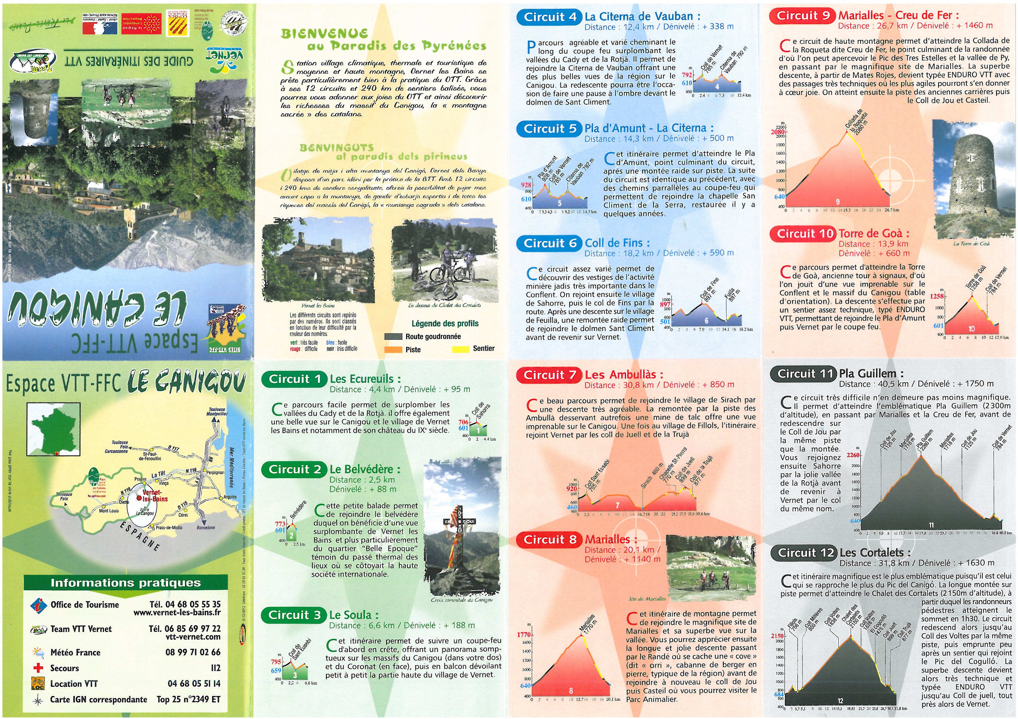
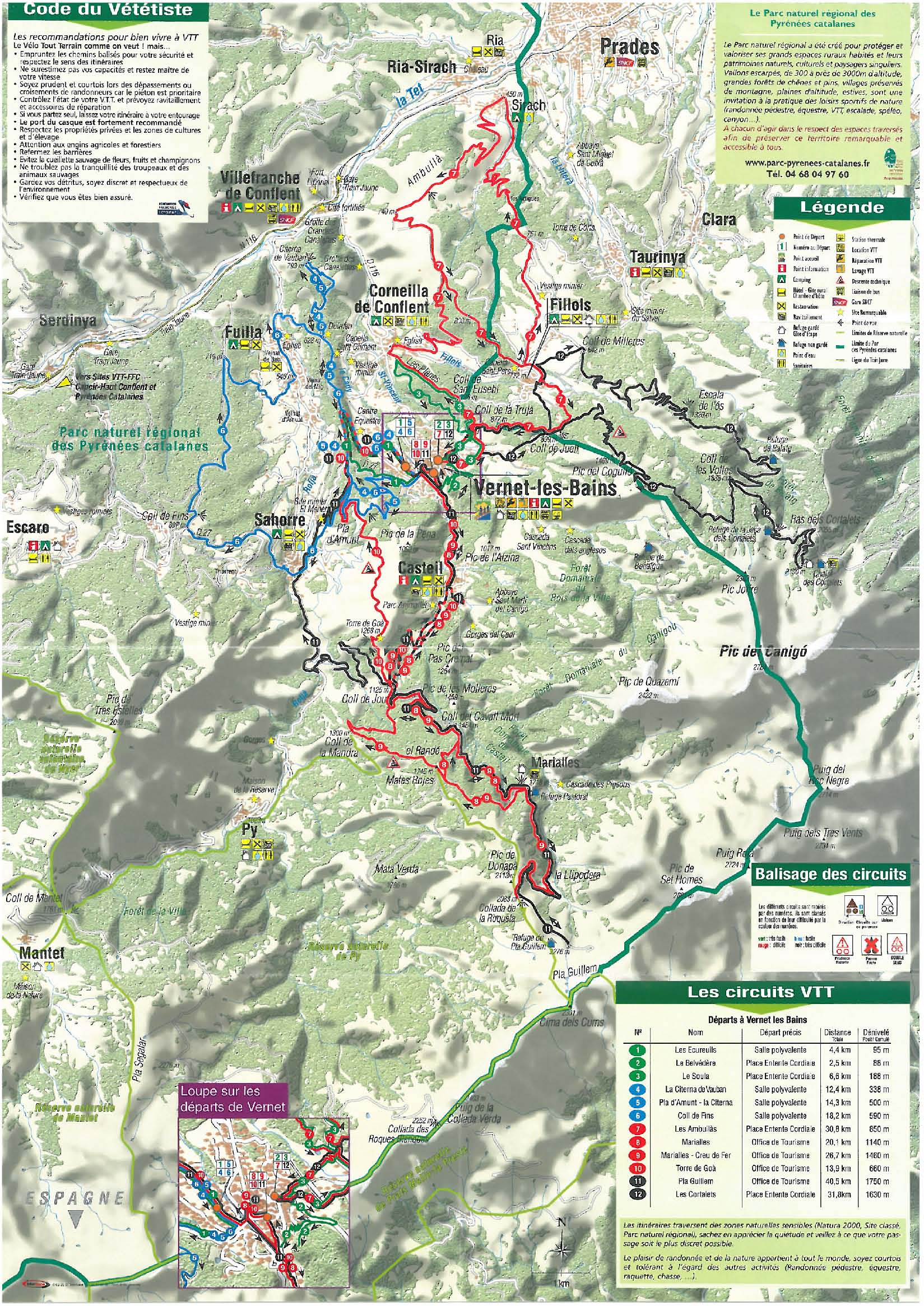
Both Vernet and Arles are provided by the FFC with a selection of graded VTT routes, which we based some of our rides around. In Vernet there is a free leaflet (illustrated right: click on each thumbnail) outlining the routes but giving no other information. In Arles each route has a laminated informative route sheet to buy for €1.50. The routes are reasonably well signposted but sometimes a sign was missing or a turn not well enough marked. The grading (green/blue/red/black) seems mostly to be on length and amount of climbing rather than technical difficulty. The routes follow a mixture of unsurfaced roads and forest roads, and established footpaths. We couldn't ride all the paths but the challenges were interesting, and some sections are certainly unrideable.
We also used tracks and some footpaths not on the VTT routes. As far as we know it is all right to cycle on waymarked paths except in some National Parks, but you face the problem you don't know how rideable any path is - and one path I tried to find seemed nonexistent.
Rides from Vernet
Roques Blanques
Cortalets.
Canigou.
Around Taurinya. We had a rather meandering exploratory ride the first afternoon. From Corneilla on the road to Fillols but took the track to the left about halfway, which takes you to a junction at la Collade. These tracks are used by the FFC's route 7. We had planned to go to Sirach but saw a “false route” sign, and thinking this meant bikes were banned that way, we took the VTT direction sign which took us to Fillols. In fact that’s not what the crossed-out bike sign means, it simply means that’s not the waymarked route. From Fillols we rode to the Col de Milleres and down the footpath to Taurinya. This is a lovely, lovely descent - just challenging enough for us. We then did a little loop to Cassanet and past the Tour de Cours, a quite and overgrown track through woods. Finally, took the right track forking off the Fillols road which sort of crests a hilltop. This track seems to just become a woodland path before meeting a track agaain before the road and we were never quite sure we had gone the right way, but it was fun. We were going to ride back on the road but couldn’t resist taking the ridge track from the Col St Eusebe down towards Corneilla and back up the gentler forest track back to Vernet. There had been a VTT race the previous weekend and we followed the arrows, taking a sweet little path with tight corners to roll into Vernet. (30km, 800m).
St Martin and Col de Jou.
Prades and back.
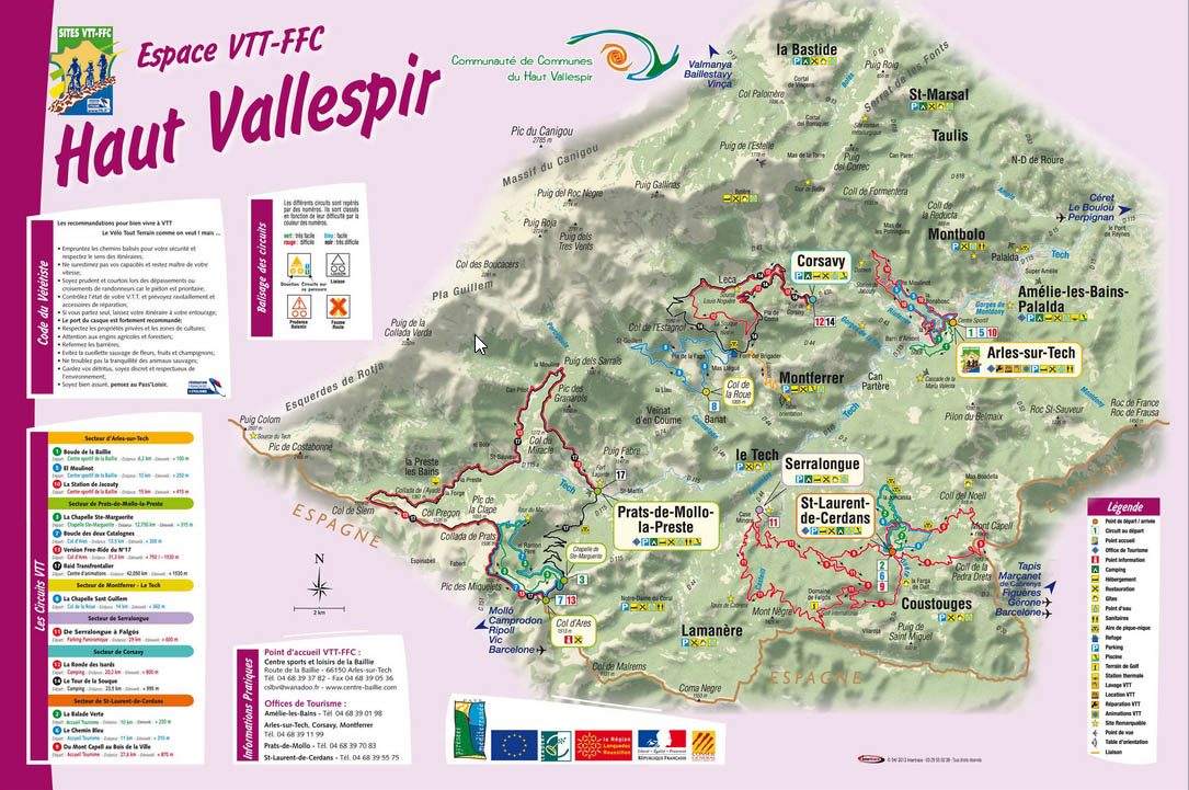
Rides from Arles-sur-Tech
We relied more on the FFC’s routes in this area, and we used the car a lot more to get to the start of rides. There is a wealth of forestry tracks in the valley but it is not clear from the map whether they are going to be interesting or not.
Le tour de la Souque.
Raid Transfrontalier
It is a long ride and although we had taken some couscous, a proper lunch was called for. There is nothing at Preste-les-Bains (the hotel was closed) so we hammered down to Prats. The restaurants seem to stay open longish hours for lunch - they do serve Spaniards. It started raining so we postponed the second part of the ride. (37km, 1170m).
We returned to complete it on our last day in the mountains, but spun it out a little more by riding up towards the Cabane Pastorale des Estables. The road to Can Pitot and the forest track are a little steep at times but otherwise straightforward and you have decent views. We descended to the junction at 1470m to take a nicely overgrown old road past la Mouline, dropping to about 1200m in the valley. There’s not a great deal more up to regain to the Coll del Miracle, and from there it's a narrow, entertaining but mostly rideable descent. (31km, 1140m).
Els Vigourats – Tour de la Batere. Tracey did this alone; Colin rested. Tracey is suffering more right now. From Corsavy, the road past the Creperie and into the Riuferrer valley. Heart plummets at same rate as valuable altitude lost. Sharp right to Els Vigourats near the bottom, this is rough concrete, becoming a reasonably interestingly surfaced track. The steepest sections are lower down - it does get easier higher up. Just before the final turn to the top house, there’s a right (sort of straight-on at a bend) onto a more overgrown track which levels off. Cross the GR10 path and reach a hairpin bend on a better-looking track. I took the left and continued climbing on this overgrown track through mixed woodland. It’s straightforward but it’s worth chcking the map for false turns. Eventually emerge at a clearing beynd which I found a sort of hippy camp. Continued to the road - this is all open now with pastures around an expansive views. I belted up to the tower (there's a stretch of gravel road) and back again, descending crazily so as to catch what turned out to be the decisive stage of the 2010 Tour. (1050m).
Els Vigourats - GR10.
De Serralongue a Falgos. One of FFC's red routes. It looks from the map to be all forest tracks, but it’s a more interesting route than you might first think. We took a detour to St Laurent: we left at Col des Colomines and took a sandy forest track that crosses a waymarked horse-ride route. A little further (where the track probably stops) we took a 90 degree left, downhill, then followed the path to St Laurent - this was really rather nice. To rejoin the FFC route we used the tarmac road to Falgos which steepens insidiously. (36km, 920m).
Practicalities
Maps. We used the IGN 2349ET Massif du Canigou, and 2449OT Ceret.
Food. Vernet. There is a decent enough supermarche in Vernet, and a few boulangeries. There is a better supermarket at Prades. We ate out once, at Bistrot Le Cortal, which is run by a British couple. Corsavy. There are traditional small shops in Arles and a small Spar supermarket. For a big supermarket you have to go to Ceret. We did not eat out in the evening here as it seemed impractical to get back from Arles.
Access. We flew to Toulouse and hired a car to drive the rest of the way. There are direct flights to Perpignan but they are only seasonal.
 |
 |
The weather was indifferent, with rain predicted most days and falling most afternoons. Our ambitions were therefore curtailed, and our photographs less sunny than previously. We made little use of our swimming pools.
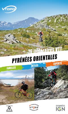
We got information from the same sources as before. We bought the Vtopo guide and we got GPS tracks from utagawa and from the Madres-Coronat and Haut Vallespir FFC sites. We got route hints from Trailforks. We had two GPS units with us: Colin’s old (and increasingly creaky) Edge 500 and his new (and disappointing) Edge 130+.